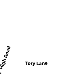
259 HIGH RD
Owner Information
SMALL TE CLAYTON G III
259 HIGH RD
NEWBURY, MA 01951


Property Details
259 HIGH RD is classified as a Single Family Residential (Colonial).
The primary structure on this property was built in 2003. There are 2,943ft2 of built area within this property. There is 2,943ft2 of residential/living space within this property. This property is listed as having 9 rooms.
259 HIGH RD is valued at $733,400. The land is valued at $290,700 and the structures are valued at $442,700.
The most recent deed for 259 HIGH RD is recorded at the local registrar in Book 35005, Page 497. 259 HIGH RD was last sold on Thursday, June 16, 2016 for $1.
Assessment data from fiscal year 2022.
Flood Data
According to the FEMA National Flood Hazard Layer, this property does not appear to be in a flood zone. It may also be in an area not yet reviewed. Nonetheless, confirm this information prior to taking any action.
To view the flood hazards around this property, create a FEMA "Firmette" Map of the area around 259 HIGH RD.
Broadband Internet Providers
| Provider | Type | Bandwidth (mbps) | |
|---|---|---|---|
| GCI Communication Corp. | Satellite | 0 | 0 |
| VSAT Systems, LLC. | Satellite | 2 | 1 |
| HughesNet | Satellite | 25 | 3 |
| Comcast | Cable | 1000 | 35 |
| Verizon New England Inc. | DSL | 10 | 1 |
| Viasat Inc | Satellite | 100 | 3 |
Broadband service provider data from December 2020.
Adjacent Properties
- 0 OFF COTTAGE RD
Vacant, Conservation Organizations (Charitable Org.) owned by THE TRUSTEES OF RESERVATIONS - 257 HIGH RD
Single Family Residential owned by MITCHELL ELIZABETH - 5 TORY LN
Two-Family Residential owned by TOLEOS RONALD T - 3 TORY LN
Single Family Residential owned by FISH TTEE PATRICIA E - 1 TORY LN
Single Family Residential owned by JOY WILLIAM - 0 OFF COTTAGE RD
Vacant, Conservation Organizations (Charitable Org.) owned by THE TRUSTEES OF RESERVATIONS